
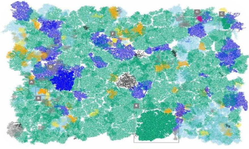
Seeing the forest from space.
Monitoring, Reporting & Verification (MRV), powered by Satellite Intelligence. Our high-resolution multispectral data provides a level of detail traditional monitoring cannot achieve from the ground alone. From individual tree health to global biomass trends, our platform enhances existing ground data to build better models.
Forest Monitoring
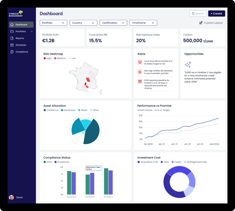
Space-grade data for ground-level decisions
Gain actionable insights through intuitive dashboards. Our satellite-powered monitoring detects changes in real-time, enabling proactive asset management.
Features
Parcel Audits
Climate Risk
Disturbance Detection
Custom Solutions

Certification Support
Informing corporate nature strategy
Navigate the complex world of FSC and PEFC certification with ease. We provide the data and documentation needed to meet global sustainability standards.
Features
FSC/PEFC Guidance
Expert Consultation
Documentation Hub
Compliance Monitoring
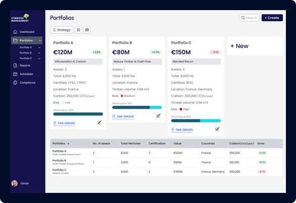
Pricing & Valuation
Comprehensive asset valuation
Leverage real-time monitoring data and our robust database for clear insights into forest value. Audit-ready reporting for investors and owners.
Features
Valuation Overview
Market Insights
Risk-Adjusted Value
Investment Analysis
Wildfire Risk
Advanced fire spread simulation
Quantify asset exposure to wildfire with high-resolution spread modelling. Our simulations account for real-time climate, wind, and vegetation data.
Features
Exposure Analysis
Spread Simulation
Fuel Load Mapping
Real-time Alerts
Capabilities
Product Deep Dive
Explore the advanced intelligence layers that power our forest management platform.
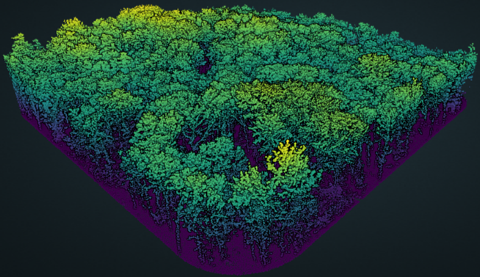
Module 01
LIDAR Point Cloud
High-density laser scanning provides a precise 3D representation of the forest structure. This data allows us to measure tree height, canopy density, and sub-canopy terrain with centimetre precision, enabling accurate biomass estimation and carbon stock auditing.
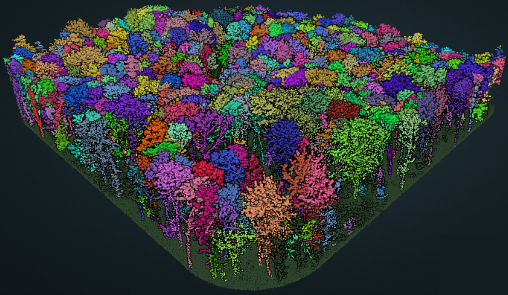
Module 02
Segmented Trees
Our proprietary machine learning models identify and segment individual trees from high-resolution satellite and aerial data. This level of granularity allows for tree-level health monitoring, species identification, and precise inventory management at any scale.
Module 03
Forest Wild Fire Analysis
Quantify asset exposure to wildfire with high-resolution spread modelling. Our simulations account for real-time climate, wind, and vegetation data to predict fire behavior and identify critical fuel breaks for protection.
Module 04
Asset Exposure Analysis
Comprehensive risk assessment for housing and infrastructure near forest boundaries. We integrate wildfire risk with property-level intelligence to provide actionable insights for insurers, banks, and real estate developers.
Built for the entire forestry ecosystem
Our platform isn't just for foresters. We provide specialized portals for insurance underwriting, institutional asset management, and real estate due diligence.
Process
How it works
Our three-step verification process ensures that every data point is accurate and actionable.
Data
Gathering high-resolution satellite imagery and ground-truth data.
Analysis
Proprietary algorithms process multi-spectral data to detect risks.
Verify
Professional foresters review and validate all AI findings.
Packages
Packages built around your forest intelligence needs
Compare the intelligence layers available for forest monitoring, climate risk and valuation. Pricing is tailored to your assets and use case.
Essential
Forest Inventory & History
Included features
- Full stand overview
- Disturbance & harvest history
- Management unit segmentation
- Platform access · Data & report export
Risk
Essential + Climate Risks
Included features
- Storm, fire & drought risk score
- Detection of declining health zones
- Climate event simulation
- Climate projections over coming decades
Intelligence
Essential + Risk + Valuation
Included features
- Valuation
- Forest market benchmarks
- Carbon sequestration: stock & flux
- Biodiversity & ecosystem indicators
- Audit-ready exports
Ready to see the platform in action?
Request AccessFAQ
Frequently Asked Questions
Build your custom forest
intelligence stack.
10-meter precision. Multi-spectral data. Your forest, digitized.